To the west of the province is a quiet town with its striking central park, the inhabitants of this canton in its majority of the Kichwa nationality, are dedicated to the production of ornamental and medicinal plants maintaining a commitment to preserve the natural wealth and support the Ecological tourism
Its capital is the city of the same name and is part of the Napo river basin. It is located in South latitude º44 'and longitude 77º27' in an altitudinal range that goes from the 320 to 3732 msnm, in the summit of the Volcano Sumaco. Its boundaries are: North: Canton El Chaco and Francisco Orellana, South: Canton Tena, Province of Napo, East: with Canton Francisco de Orellana, West: Cantons Quijos, Tena and Archidona. Its surface is 2,146.35 km2, divided into 5 rural parishes and an urban one that constitutes the cantonal head. The rural extension corresponds to 96.6% of the total area of the canton, of which the parish San José de Payamino is the most extensive.
Source:
-https: //es.wikipedia.org/wiki/Cant%C3%B3n_Loreto
-SAMANA, Tourist Guide for Travelers. Editorial Ecuatoriana. Quito, February 2010.
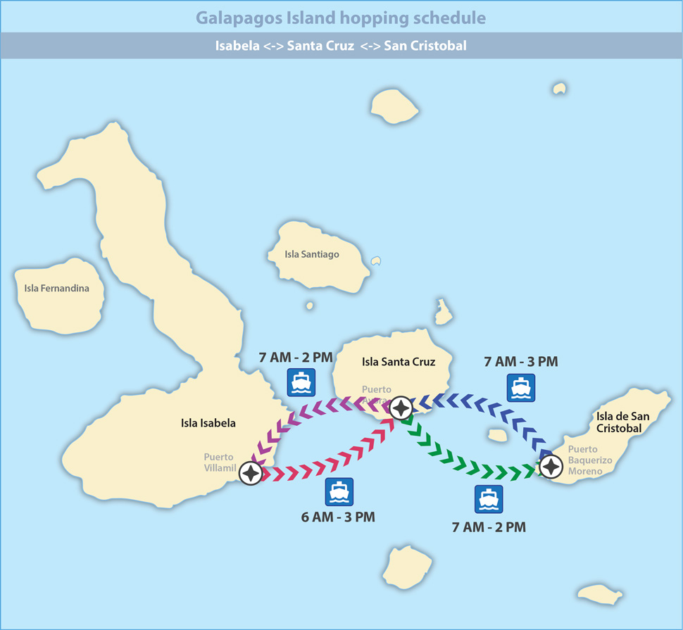
By national interoceanic route by private vehicle or by regular bus services, in 5 hours you will arrive in Loreto.


 Hotel Coca Tuesday 24 February 2026
 Tourism