The Cayambe-Coca National Park is a national park of Ecuador located along the equatorial line about 100 kilometers from Quito. The park covers an area of 3,700 km².
The hot springs of Papallacta are visited to relax in the spas and the nearby meadows of the altiplano are frequented for fishing and bird watching.
Canton Cayambe includes the pre-Inca structures Pambamarca, Temple of the Sun and the Moon in Puntiatsil and part of the Inca Trail.
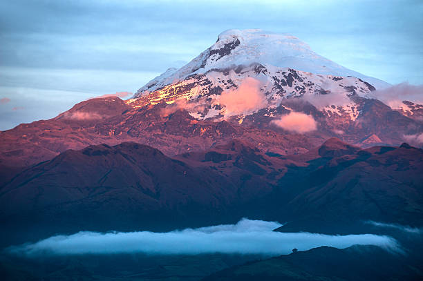
The Cayambe volcano: snow-covered volcano and favorite of alpinists. (5790 masl)
Lake Puruhanta: located in the north, the lake has paths, camping, as well as ancient ruins (called "the Table") with diverse flora and fauna.
Lake of San Marcos: the lake has 2 hours away, an observatory where the diverse flora and fauna of nature can be seen.
Oyacachi the community and the meadow
The San Rafael Waterfall: with a fall height of 131 m, it is one of the most impressive features of the park and the highest waterfall in Ecuador. It is located on the Quijos River and can be accessed by road.
Quijos: cultural and natural tourism
Cofán de Sinangoe: community in the meadow
Other summits: Sarahurco (4725 masl), El Reventador volcano (3485 masl), Cerro Puntas (4452 masl).
CLIMATE: The temperature varies according to the altitude from 5-25 ° C
                                                        The Cayambe-Coca National Park is located north of the Equator, in the central and northern part of the Eastern branch of the Andes, between the provinces of Imbabura, Pichincha, Napo and Sucumbíos with an area of 403.103 hectares and an altitudinal range It goes from 5,700 meters above sea level at the summit of the Cayambe peak to 400 meters above sea level in the Aguarico River area near Lumbaquí.
                                                        Cuenca


 Cascada río Pita Tuesday 24 February 2026
 Tourism